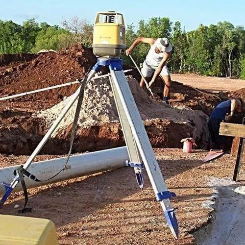
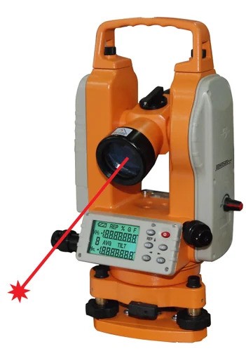
About Levelling Survey Services
Experience sizzling precision and instant savings with our splendiferous Levelling Survey Services-available for a limited time! Our first-class solutions cover all types of levelling surveys, including differential, profile, and cross-section levelling. Delivered by brilliant certified surveyors and engineers, we offer digital reports, CAD drawings, and hard copy documentation tailored to your needs. We stand out with compliance to industry and ISO standards, 24/7 technical support, complete data security, and on-site service across urban, rural, and industrial projects nationwide. Discover unrivalled accuracy and reliability for your next project now!
Why Choose Our Levelling Survey Services?
Our competitive advantages stem from a blend of high-precision equipment, skilled personnel, and flexibility in service. We cater to complex site conditions-urban, rural, or industrial-using advanced instruments for reliable results. The portability of our equipment and custom survey solutions ensure seamless adaptation to land levelling, construction, civil engineering, and topographical projects. Robust industry and ISO compliance, paired with 24/7 technical assistance, sets us apart as your preferred choice for survey service excellence.
Sample Availability and Market Outreach
Levelling Survey Services samples are provided at a premium sale price for evaluation before placing bulk orders. We proudly serve the main domestic market across India and fulfill shipped goods requirements in major export markets globally. Fast response, accurate reporting, and secure delivery ensure all goods-whether digital files or physical documentation-reach clients in prime condition. Elevate your projects with our exceptional service and reliable survey solutions, tailored for both local and international clientele.
FAQ's of Levelling Survey Services:
Q: How are your levelling survey services customised for different project needs?
A: We tailor every survey by assessing the project's specific requirements, location, and complexity, ensuring customised solutions using our advanced equipment and skilled surveyors for optimal results.
Q: What data output formats do you provide after completing levelling surveys?
A: Upon completion, we deliver survey results in digital reports, CAD drawings, and hard copies, allowing clients to select the format most suitable for their project requirements.
Q: Where can your levelling survey services be applied?
A: Our services are suitable for urban, rural, and industrial sites, covering applications in land levelling, construction, civil engineering, and topographical surveys across various environments.
Q: When can I expect project delivery after requesting your survey service?
A: Project delivery time varies, depending on the area size and complexity. Specific timelines are communicated upfront, ensuring clear scheduling and reliable delivery.
Q: What benefits do your levelling surveys offer over traditional methods?
A: Our services provide unmatched accuracy up to 2 mm/km, real-time digital output, fast data processing, and reliability-even in harsh conditions-giving clients dependable and swift project results.
Q: How is data confidentiality and security ensured during the survey process?
A: We follow stringent data confidentiality and industry-approved security protocols to protect all client information from the initial survey right through to data delivery.


 Send Inquiry

 Send Inquiry
 Send SMS
 Call Me Free
 English
 Spanish
 French
 German
 Italian
 Chinese (Simplified)
 Japanese
 Korean
 Arabic
 Portuguese