About GPS Survey Services
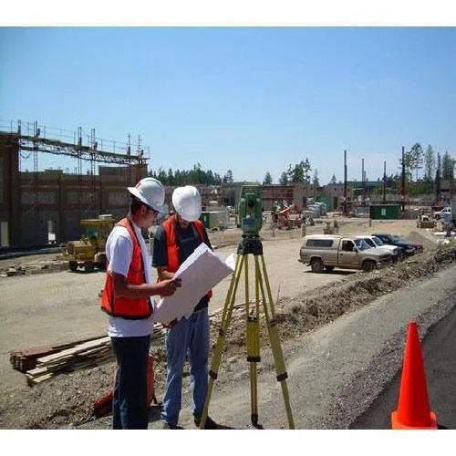
Experience our Elite GPS Survey Services, designed for those who demand centimeter-level precision in land and topographic surveys. Using dual-frequency GNSS/GPS receivers and processed with the latest industry-standard software, we guarantee Dazzling accuracy and digital outputs compatible with AutoCAD and GIS. At an unbeatable price, enjoy instant savings without compromising quality. Our noteworthy certified professionals deliver projects within seven days for up to 200 acres, with full technical support and strict data confidentiality. Ideal for construction, real estate, infrastructure, and industrial sectors across India.
Versatile Solutions for Every Surface and Application
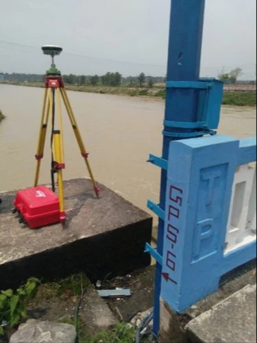
Our GPS Survey Services are expertly used as topographic and land surveys across a variety of terrains. The use type is strictly offline and field-verified, guaranteeing accuracy in surface of application, be it large construction sites, real estate developments, or industrial project areas. As a leading manufacturer, service provider, supplier, and trader, we cater to diverse industries seeking high-precision results throughout India.
Premium Terms: Hassle-free Handover and Quick Dispatch
We ensure swift processing-from quick dispatch of our certified field teams to premium project handover within seven days. Flexible payment terms and high supply ability, covering up to 200 acres per project, simplify client operations. For select projects, sample data sets are available, allowing clients to preview deliverables and quality before commencement. Our commitment to excellence guarantees complete client satisfaction through every phase of the service.
FAQ's of GPS Survey Services:
Q: How accurate are your GPS Survey Services?
A: Our GPS Survey Services provide centimeter-level precision using advanced dual-frequency GNSS/GPS receivers, ensuring reliable and highly detailed data for every project.
Q: What types of projects can benefit from your survey services?
A: Our survey solutions are ideal for construction, infrastructure, real estate, and industrial applications, offering exceptional accuracy and digital data compatibility with AutoCAD and GIS formats.
Q: When will I receive the completed survey data?
A: We deliver all survey results within seven days of project commencement, ensuring timely access to critical information for your projects.
Q: Where is your GPS Survey Service available?
A: Our services are available across India, covering project areas up to 200 acres and tailored to industry needs nationwide.
Q: What is the process for engaging your survey team?
A: Once you contact us, our certified professionals schedule on-site data collection, process the data using the latest software, and provide digital deliverables compatible with your preferred formats.
Q: How do I know my data is kept confidential?
A: We maintain strict client confidentiality as a core policy, from fieldwork to data processing and delivery, safeguarding your project's sensitive information.
Q: What support services do you offer post-survey?
A: We provide comprehensive technical support and post-survey assistance to address any questions or technical needs after data handover.


 Send Inquiry


 Send Inquiry
 Send SMS
 English
 Spanish
 French
 German
 Italian
 Chinese (Simplified)
 Japanese
 Korean
 Arabic
 Portuguese